


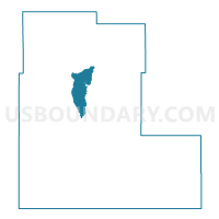
Otero County Precinct 9, Otero County, New Mexico
About
Outline

Summary
| Unique Area Identifier | 623779 |
| Name | Otero County Precinct 9 |
| County | Otero County |
| State | New Mexico |
| Area (square miles) | 128.33 |
| Land Area (square miles) | 128.31 |
| Water Area (square miles) | 0.02 |
| % of Land Area | 99.98 |
| % of Water Area | 0.02 |
| Latitude of the Internal Point | 32.85660530 |
| Longtitude of the Internal Point | -105.85837550 |
Maps

Graphs
Select a template below for downloading or customizing gragh for Otero County Precinct 9, Otero County, New Mexico


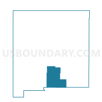
Neighbors
Neighoring Voting District (by Name) Neighboring Voting District on the Map
- Otero County Precinct 10, Otero County, NM
- Otero County Precinct 11, Otero County, NM
- Otero County Precinct 18, Otero County, NM
- Otero County Precinct 21, Otero County, NM
- Otero County Precinct 24, Otero County, NM
- Otero County Precinct 28, Otero County, NM
- Otero County Precinct 35, Otero County, NM
- Otero County Precinct 40, Otero County, NM
- Otero County Precinct 5, Otero County, NM
- Otero County Precinct 8, Otero County, NM
Top 10 Neighboring County Subdivision (by Population) Neighboring County Subdivision on the Map
- Alamogordo CCD, Otero County, NM (40,933)
- Southeast Otero CCD, Otero County, NM (13,108)
- Mescalero CCD, Otero County, NM (3,613)
Top 10 Neighboring Place (by Population) Neighboring Place on the Map
- Alamogordo city, NM (30,403)
- La Luz CDP, NM (1,697)
- Boles Acres CDP, NM (1,638)
- High Rolls CDP, NM (834)
Top 10 Neighboring Unified School District (by Population) Neighboring Unified School District on the Map
- Alamogordo Public Schools, NM (43,326)
- Tularosa Municipal Schools, NM (8,735)
- Cloudcroft Municipal Schools, NM (2,993)
Top 10 Neighboring State Legislative District Lower Chamber (by Population) Neighboring State Legislative District Lower Chamber on the Map
- State House District 53, NM (36,271)
- State House District 56, NM (25,946)
- State House District 59, NM (25,797)
Top 10 Neighboring State Legislative District Upper Chamber (by Population) Neighboring State Legislative District Upper Chamber on the Map
- State Senate District 40, NM (46,725)
- State Senate District 32, NM (46,022)
- State Senate District 34, NM (45,445)
Top 10 Neighboring 111th Congressional District (by Population) Neighboring 111th Congressional District on the Map
Top 10 Neighboring Census Tract (by Population) Neighboring Census Tract on the Map
- Census Tract 9.02, Otero County, NM (9,941)
- Census Tract 4.02, Otero County, NM (6,888)
- Census Tract 4.01, Otero County, NM (5,052)
- Census Tract 9400, Otero County, NM (3,613)
- Census Tract 3.04, Otero County, NM (3,359)
- Census Tract 3.06, Otero County, NM (3,248)
- Census Tract 9.01, Otero County, NM (3,167)
- Census Tract 6.03, Otero County, NM (2,628)
- Census Tract 6.02, Otero County, NM (2,132)
Top 10 Neighboring 5-Digit ZIP Code Tabulation Area (by Population) Neighboring 5-Digit ZIP Code Tabulation Area on the Map
- 88310, NM (35,776)
- 88340, NM (3,616)
- 88337, NM (2,295)
- 88317, NM (1,751)
- 88325, NM (899)
- 88350, NM (368)
- 88349, NM (70)